PROJECT DETAILS
Client: Metro Transit
Location: Minneapolis, Richfield, Bloomington and Burnsville, MN
PROJECT DESCRIPTION
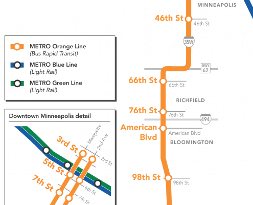
In an effort to make strategic investments in a growing network of bus and rail transitway to increase transportation choices and foster economic activity, the Metropolitan Council was seeking Architectural and Engineering design services for the Metro Transit Orange Line, a 17-mile planned highway BRT line between Minneapolis, Richfield, Bloomington, and Burnsville.
RANI SOLUTION
The Rani team completed the topographic and boundary surveys for five areas that will contain new or updated bus stations. Rani also coordinated the surface marking of utilities via the Gopher State One Call system and surveyed these locations. Based on the field data collected, Rani produced surface models and planimetric drawings at each site. Rani also aided in developing various easements for the construction of and permanent placement of the associated infrastructure for the Line.
Professional services included:
- Providing land surveying services for precise location and mapping of existing and proposed right-of-way, proposed easements, and land boundaries defining the project limits at each proposed station and design area.
- Providing existing conditions surveys at each design location which included: Topographical features, site improvements, and utilities.
- Preparing the base mapping required for design.
- Performed coordinate datum transformation in order to present boundary information to multiple stake holders.
- Coordinated Gopher State One Call services for field locates to be mapped.
- Coordinated a nighttime lane closure with a sub consultant to avoid collection of utility data in live traffic on an on ramp connecting two major highways.


